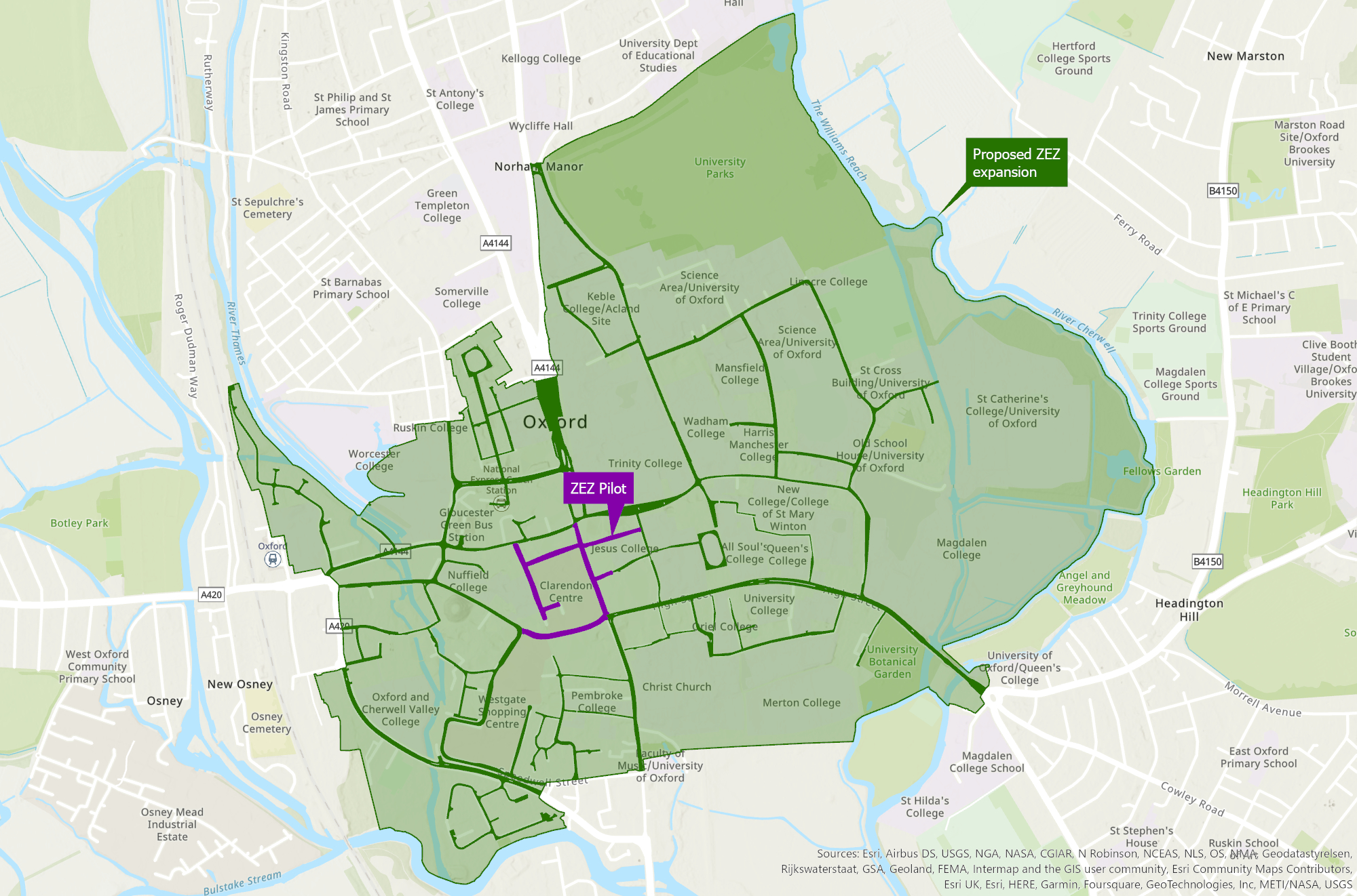
View a map of the zero emission zone (ZEZ)
Map of area and streets included in Oxford's zero emission zone.
The zero emission zone covers the following streets in Oxford city centre.
| Street | Length |
|---|---|
| New Road | Between Bonn Square and its junction with Castle Street |
| Bonn Square | Whole length |
| Queen Street | Whole length |
| Cornmarket Street | Whole length |
| New Inn Hall Street | Whole length |
| Shoe Lane | Whole length |
| Market Street | From its junction with Cornmarket, extending east for 40 metres |
| Ship Street | Whole length |
| St Michael’s Street | Whole length |
Map
View a map showing the pilot roads (pdf format, 1.2Mb) or a map showing the proposed second phase zones (jpg format, 700KB).
If you have driven into the zero emission zone, you will have entered via one of the streets below. Click on the street name to view in Google Street View.
- New Inn Hall Street
- Turl Street/Ship Street
- Bonn Square (part-pedestrianised)
- Cornmarket (part-pedestrianised)
- Market Street (part-pedestrianised)
ZEZ emission zone signage
The emission zone is marked by signage as shown below.

Other travel options
To improve Oxford’s air quality and avoid paying ZEZ charges you can choose to walk, cycle, e-scoot or use public transport (including park and ride).
We encourage sustainable travel through our Local Transport Plan.